2022 Map of Portland
USGS Topo · Published 2022About this map
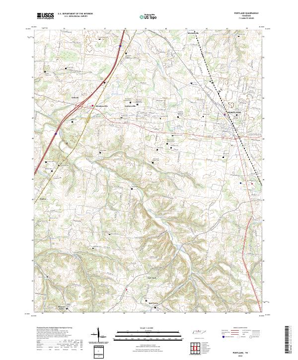
Portland serves as the primary hub in this northern Tennessee landscape, where the CSX Transportation line and the Ronnie McDowell Pkwy facilitate modern transit through the borderlands of Robertson Co and Sumner Co. The surrounding countryside is defined by agricultural plateaus and the drainage systems of the Red River and Hall Town Cr. This area is exceptionally dense with family burial sites and rural churchyards, such as the White Family Burial Ground, Old Halltown Cem, and Byrams Chapel Cem, offering a detailed view of the region's genealogical history. Small communities like Scattersville, Reubensville, and Mitchellville are connected by a web of named roads including Blue Door Rd and Breeder Rd, illustrating a transition from traditional farmsteads to contemporary rural residential development near Phillip Bradshaw Lake.
Find a feature on this map
128 named features on this map. Tap any name to fly to it.
Don’t see what you’re looking for? This feature index may not catch every label — zoom into the map to look around manually.
Map Details
Editions of this 2022 Portland Map
This is the sole edition of this map. No revisions or reprints were ever made.