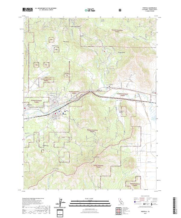
2021 Map of Portola
USGS Topo · Published 2021About this map
The Middle Fork Feather River carves through this high-altitude landscape, anchoring the city of Portola and the historic community of Beckwourth. This area reflects a deep connection to early California transportation and timber history, with Western Pacific Way tracing the path of the railroad through the canyon. The northern reaches are dominated by Lake Davis and the surrounding timberlands of the Plumas National Forest, while the southern portion of the map is defined by the massive profile of Beckwourth Peak.
Find a feature on this map
88 named features on this map. Tap any name to fly to it.
Don’t see what you’re looking for? This feature index may not catch every label — zoom into the map to look around manually.
Map Details
Editions of this 2021 Portola Map
This is the sole edition of this map. No revisions or reprints were ever made.
Other maps of this area

1890 · Sierraville
USGS Topo · 1:125,000

1891 · Downieville
USGS Topo · 1:125,000

1892 · Sierraville
USGS Topo · 1:125,000

1893 · Downieville
USGS Topo · 1:125,000

1894 · Sierraville
USGS Topo · 1:125,000

1895 · Downieville
USGS Topo · 1:125,000

1896 · Downieville
USGS Topo · 1:125,000

1897 · Downieville
USGS Topo · 1:125,000

1937 · Blairsden
USGS Topo · 1:48,000

1943 · Blairsden
USGS Topo · 1:62,500