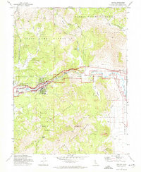
1972 Map of Portola
USGS Topo · Published 1974About this map
Portola serves as the primary hub of this Plumas County landscape, situated where the Western Pacific railroad tracks trace the course of the Middle Fork Feather River. The settlement pattern in the early 1970s is concentrated around the river valley, with the adjacent community of Delleker and the village of Beckwourth to the east. Local history is anchored by the Shady Grove Cem and Whispering Pines Cem, alongside the local High Sch.
Find a feature on this map
38 named features on this map. Tap any name to fly to it.
Don’t see what you’re looking for? This feature index may not catch every label — zoom into the map to look around manually.
Map Details
Editions of this 1972 Portola Map
This is the sole edition of this map. No revisions or reprints were ever made.
Other maps of this area

1890 · Sierraville
USGS Topo · 1:125,000

1891 · Downieville
USGS Topo · 1:125,000

1892 · Sierraville
USGS Topo · 1:125,000

1893 · Downieville
USGS Topo · 1:125,000

1894 · Sierraville
USGS Topo · 1:125,000

1895 · Downieville
USGS Topo · 1:125,000

1896 · Downieville
USGS Topo · 1:125,000

1897 · Downieville
USGS Topo · 1:125,000

1937 · Blairsden
USGS Topo · 1:48,000

1943 · Blairsden
USGS Topo · 1:62,500