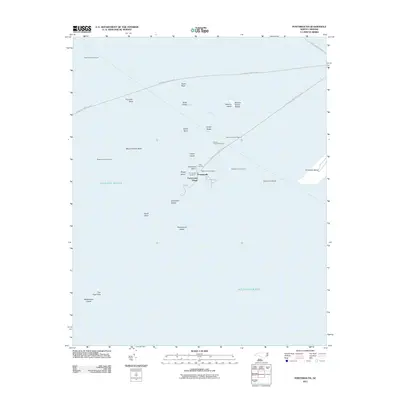
2011 Map of Portsmouth
USGS Topo · Published 2011About this map
Portsmouth Village sits at the northern end of Portsmouth Island, serving as a focal point for this coastal survey of the Outer Banks. The landscape is defined by the shifting interface of land and water, featuring several family and local burial grounds including the Community Cemetery and Babb-Dixon Cemetery. Maritime navigation is essential to this area, evidenced by the Ferry Landing and various aids like Wallace Channel Light and Sheep Island Slue Light.
Find a feature on this map
31 named features on this map. Tap any name to fly to it.
Don’t see what you’re looking for? This feature index may not catch every label — zoom into the map to look around manually.
Map Details
Editions of this 2011 Portsmouth Map
This is the sole edition of this map. No revisions or reprints were ever made.
Other maps of this area

1948 · Portsmouth
USGS Topo · 1:24,000
1948 · Ocracoke
USGS Topo · 1:24,000

1950 · Howard Reef
USGS Topo · 1:24,000

1950 · Portsmouth
USGS Topo · 1:24,000

1953 · Rocky Mount
USGS Topo · 1:250,000

1953 · Beaufort
USGS Topo · 1:250,000

1954 · Rocky Mount
USGS Topo · 1:250,000

1954 · Beaufort
USGS Topo · 1:250,000

1955 · Wanchese
USGS Topo · 1:250,000

1957 · Manteo
USGS Topo · 1:250,000