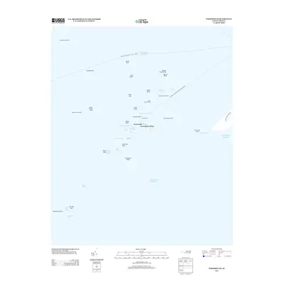
2013 Map of Portsmouth
USGS Topo · Published 2013About this map
Portsmouth Village sits at the northern tip of Portsmouth Island, a remote landscape of maritime history and shifting shoals within the Cape Hatteras Seashore. This 2013 survey highlights the intricate network of tidal waterways and sand features that define the entrance to Pamlico Sound, including Ocracoke Inlet and the hazardous Vera Cruz Shoal. Historically significant maritime markers like the Wallace Channel Light and Sheep Island Slue Light guide vessels through channels such as Blair Channel and the Horse Island Channel. The map documents a landscape governed by water, where the only connections to the mainland are via the Ocracoke-Cedar Island Ferry Crossing. Inland labels like The Haulover and Warren Gilgos Creek provide specific points of reference for those tracing the traditional layout of this historic coastal outpost.
Find a feature on this map
43 named features on this map. Tap any name to fly to it.
Don’t see what you’re looking for? This feature index may not catch every label — zoom into the map to look around manually.
Map Details
Editions of this 2013 Portsmouth Map
This is the sole edition of this map. No revisions or reprints were ever made.
Other maps of this area

1948 · Portsmouth
USGS Topo · 1:24,000
1948 · Ocracoke
USGS Topo · 1:24,000

1950 · Howard Reef
USGS Topo · 1:24,000

1950 · Portsmouth
USGS Topo · 1:24,000

1953 · Rocky Mount
USGS Topo · 1:250,000

1953 · Beaufort
USGS Topo · 1:250,000

1954 · Rocky Mount
USGS Topo · 1:250,000

1954 · Beaufort
USGS Topo · 1:250,000

1955 · Wanchese
USGS Topo · 1:250,000

1957 · Manteo
USGS Topo · 1:250,000