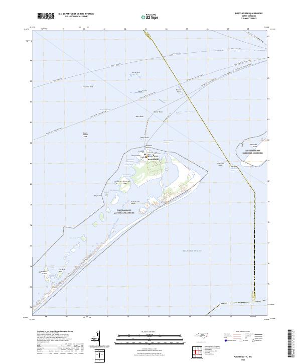
2022 Map of Portsmouth
USGS Topo · Published 2022About this map
The settlement of Portsmouth anchors this coastal survey, situated on the north end of Portsmouth Island within the Cape Lookout National Seashore. This barrier island landscape is defined by the shifting waters of Pamlico Sound and the Atlantic Ocean, separated by the historic Ocracoke Inlet. The map reveals a high density of burial grounds in a small area, including Portsmouth Cem, Grace Cem, and the Babb - Dixon Cem, reflecting the deep familial roots of this maritime community. Navigation routes are central to the region's character, with several named channels such as Wallace Channel and Blair Channel threading through the shoals. To the north, the boundary between Hyde and Carteret counties cuts through the sound, where rocky outcrops like Shell Castle and Beacon Island stand amidst the vehicle ferry trails connecting the Outer Banks.
Find a feature on this map
48 named features on this map. Tap any name to fly to it.
Don’t see what you’re looking for? This feature index may not catch every label — zoom into the map to look around manually.
Map Details
Editions of this 2022 Portsmouth Map
This is the sole edition of this map. No revisions or reprints were ever made.
Other maps of this area

1948 · Portsmouth
USGS Topo · 1:24,000
1948 · Ocracoke
USGS Topo · 1:24,000

1950 · Howard Reef
USGS Topo · 1:24,000

1950 · Portsmouth
USGS Topo · 1:24,000

1953 · Rocky Mount
USGS Topo · 1:250,000

1953 · Beaufort
USGS Topo · 1:250,000

1954 · Rocky Mount
USGS Topo · 1:250,000

1954 · Beaufort
USGS Topo · 1:250,000

1955 · Wanchese
USGS Topo · 1:250,000

1957 · Manteo
USGS Topo · 1:250,000