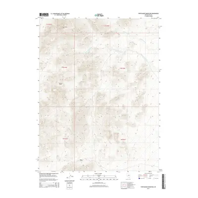
2014 Map of Portuguese Mountain
USGS Topo · Published 2014About this map
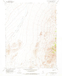
The Pancake Range dominates this corner of Nye County, where the high-altitude topography of the Great Basin is meticulously detailed. This area is characterized by the prominent peak of Portuguese Mtn and the deep incisions of Wood Canyon. In a landscape defined by aridity, the location of water is paramount; here, the map documents critical water sources like Ike Spring and Little Ike Spring, as well as the seasonal drainages of Ike Spring Wash and Little Ike Spring Wash.
Find a feature on this map
14 named features on this map. Tap any name to fly to it.
Don’t see what you’re looking for? This feature index may not catch every label — zoom into the map to look around manually.
Map Details
Editions of this 2014 Portuguese Mountain Map
This is the sole edition of this map. No revisions or reprints were ever made.
Other maps of this area

1956 · Lund
USGS Topo · 1:250,000

1960 · Lund
USGS Topo · 1:250,000

1964 · Blue Eagle Springs
USGS Topo · 1:62,500

1964 · Duckwater
USGS Topo · 1:62,500

1968 · Portuguese Mtn
USGS Topo · 1:62,500
1968 · Brown Summit SW
USGS Topo · 1:24,000
1968 · Sand Spring
USGS Topo · 1:24,000
1968 · Black Rock Summit
USGS Topo · 1:24,000

1968 · Portuguese Mtn
USGS Topo · 1:24,000
1968 · Portuguese Mtn NW
USGS Topo · 1:24,000