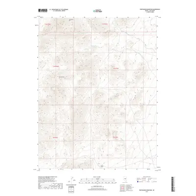
2018 Map of Portuguese Mountain
USGS Topo · Published 2018About this map
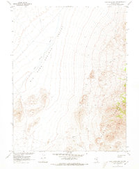
Portuguese Mtn and the high elevations of the Pancake Range dominate this interior portion of Nye County. The landscape is defined by its drainage patterns and isolated water sources, essential features for survival and navigation in this arid environment. Significant natural features include the Wood Canyon to the south and a series of springs that provide vital water points across the high desert, such as Ike Spring, Little Ike Spring, and Martin Spring. These points of interest are connected by seasonal drainages like Ike Spring Wash and Little Ike Spring Wash, which illustrate the hydrological movement through the high-altitude terrain. The map provides a precise look at the township and range boundaries that grid this largely undeveloped region, showing how the land was surveyed into sections across T11N through T9N.
Find a feature on this map
14 named features on this map. Tap any name to fly to it.
Don’t see what you’re looking for? This feature index may not catch every label — zoom into the map to look around manually.
Map Details
Editions of this 2018 Portuguese Mountain Map
This is the sole edition of this map. No revisions or reprints were ever made.
Other maps of this area

1956 · Lund
USGS Topo · 1:250,000

1960 · Lund
USGS Topo · 1:250,000

1964 · Blue Eagle Springs
USGS Topo · 1:62,500

1964 · Duckwater
USGS Topo · 1:62,500

1968 · Portuguese Mtn
USGS Topo · 1:62,500
1968 · Brown Summit SW
USGS Topo · 1:24,000
1968 · Sand Spring
USGS Topo · 1:24,000
1968 · Black Rock Summit
USGS Topo · 1:24,000

1968 · Portuguese Mtn
USGS Topo · 1:24,000
1968 · Portuguese Mtn NW
USGS Topo · 1:24,000