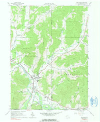
1961 Map of Portville
USGS Topo · Published 1990About this map
The Allegheny River and Oswayo River converge in this river-valley landscape at the border of New York and Pennsylvania. In the early 1960s, the village of Portville served as a central hub, supported by the Pennsylvania Railroad and the primary Pennsylvania Road corridor. Smaller residential clusters and crossroads such as Lake View Terrace, Westons Mills, and Toll Gate Corner illustrate the post-war settlement pattern of Cattaraugus County.
Find a feature on this map
62 named features on this map. Tap any name to fly to it.
Don’t see what you’re looking for? This feature index may not catch every label — zoom into the map to look around manually.
Map Details
Editions of this 1961 Portville Map
Other maps of this area

1898 · Olean
USGS Topo · 1:62,500

1925 · Belmont
USGS Topo · 1:62,500

1933 · Smethport
USGS Topo · 1:62,500

1934 · Coudersport
USGS Topo · 1:48,000

1937 · Smethport
USGS Topo · 1:62,500

1938 · Coudersport
USGS Topo · 1:62,500

1938 · Olean
USGS Topo · 1:62,500

1939 · Belmont
USGS Topo · 1:62,500

1943 · Olean
USGS Topo · 1:62,500

1957 · Warren
USGS Topo · 1:250,000