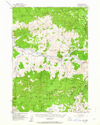
1951 Map of Post
USGS Topo · Published 1964About this map
The Crooked River winds through the heart of this central Oregon landscape, serving as the primary corridor for early settlement and transport in the region. At the time of this 1951 field check, the small community of Post and the Post School stand as the local hubs for ranching families in the valley. The map reveals a transition from the river bottom to the high timber of the Ochoco National Forest and the Maury Mountains to the south.
Find a feature on this map
75 named features on this map. Tap any name to fly to it.
Don’t see what you’re looking for? This feature index may not catch every label — zoom into the map to look around manually.
Map Details
Editions of this 1951 Post Map
3 editions found
Other maps of this area

1946 · Eagle Rock
USGS Topo · 1:62,500

1948 · Eagle Rock
USGS Topo · 1:62,500

1948 · Ochoco Reservoir
USGS Topo · 1:62,500

1950 · Ochoco Reservoir
USGS Topo · 1:62,500

1951 · Post
USGS Topo · 1:62,500

1951 · Lookout Mtn
USGS Topo · 1:62,500

1955 · Crescent
USGS Topo · 1:250,000

1955 · Bend
USGS Topo · 1:250,000

1957 · Crescent
USGS Topo · 1:250,000

1957 · Bend
USGS Topo · 1:250,000