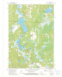
1973 Map of Post Lake
USGS Topo · Published 1990About this map
The Wolf River defines the hydrologic character of this northern Wisconsin landscape, connecting a complex chain of water bodies including Upper Post Lake and Lower Post Lake. At the center of the sheet, the settlement of Post Lake serves as a focal point for the region's recreational and natural resources, featuring a Public Access point and Wayside Park Boat Ramp. The surrounding terrain is a mosaic of wetlands and smaller lakes such as Miniwakan Lake, Aninaun Lake, and Bishop Lake, which includes a dedicated Boat Ramp for local access.
Find a feature on this map
34 named features on this map. Tap any name to fly to it.
Don’t see what you’re looking for? This feature index may not catch every label — zoom into the map to look around manually.
Map Details
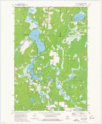
Editions of this 1973 Post Lake Map
2 editions found
Other maps of this area

1939 · Crandon
USGS Topo · 1:48,000

1940 · Monico
USGS Topo · 1:48,000

1941 · Crandon
USGS Topo · 1:48,000

1942 · Elcho
USGS Topo · 1:48,000

1942 · Pearson
USGS Topo · 1:48,000

1947 · Crandon
USGS Topo · 1:48,000

1950 · Monico
USGS Topo · 1:48,000

1950 · Elcho
USGS Topo · 1:48,000

1950 · Lily
USGS Topo · 1:48,000

1954 · Iron Mountain
USGS Topo · 1:250,000