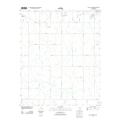
2012 Map of Post Oak Creek
USGS Topo · Published 2012About this map
Indiahoma and Cache anchor the northwest and northeast corners of this Comanche County landscape, which is defined by the braided drainage systems of the Wichita Mountains foothills. The terrain is intricately carved by Post Oak Cr and its tributary, Little Post Oak Cr, as they wind southward through a grid of section-line roads. A notable local landmark, the Indian Cem, sits just west of Cache, while the curious label Missile Base Rd hints at the proximity of Fort Sill and the region's mid-century military history. The map captures the agricultural and rural residential character of the plains, where Sandy Cr and W Cache Cr create natural breaks in the geometric road network established by routes like Old US Hwy 62 and SW Lee Blvd.
Find a feature on this map
46 named features on this map. Tap any name to fly to it.
Don’t see what you’re looking for? This feature index may not catch every label — zoom into the map to look around manually.
Map Details
Editions of this 2012 Post Oak Creek Map
This is the sole edition of this map. No revisions or reprints were ever made.
Other maps of this area

1937 · Cache
USGS Topo · 1:48,000

1937 · Quanah Mountain
USGS Topo · 1:24,000

1942 · Cache
USGS Topo · 1:62,500

1949 · Mount Scott
USGS Topo · 1:24,000

1949 · Quanah Mountain
USGS Topo · 1:24,000

1950 · Snyder
USGS Topo · 1:62,500

1955 · Lawton
USGS Topo · 1:250,000

1956 · Post Oak Creek
USGS Topo · 1:24,000

1956 · Odetta
USGS Topo · 1:24,000
1956 · Quanah Mountain
USGS Topo · 1:24,000