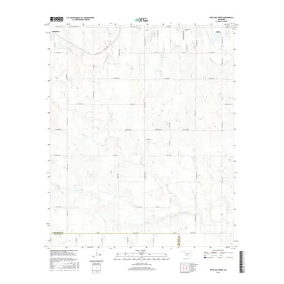
2016 Map of Post Oak Creek
USGS Topo · Published 2016About this map
Post Oak and Woodlawn sit within a landscape defined by the drainage of Post Oak Creek and its tributaries in this Comanche County area. The map illustrates a transition between the established communities of Indiahoma to the northwest and Cache to the northeast, linked by the path of Old US Hwy 62 and Railroad 1. The rural character is punctuated by several man-made water bodies, including 031018 Reservoir and 031019 Reservoir, which support the agricultural and ranching operations of the region.
Find a feature on this map
56 named features on this map. Tap any name to fly to it.
Don’t see what you’re looking for? This feature index may not catch every label — zoom into the map to look around manually.
Map Details
Editions of this 2016 Post Oak Creek Map
This is the sole edition of this map. No revisions or reprints were ever made.
Other maps of this area

1937 · Cache
USGS Topo · 1:48,000

1937 · Quanah Mountain
USGS Topo · 1:24,000

1942 · Cache
USGS Topo · 1:62,500

1949 · Mount Scott
USGS Topo · 1:24,000

1949 · Quanah Mountain
USGS Topo · 1:24,000

1950 · Snyder
USGS Topo · 1:62,500

1955 · Lawton
USGS Topo · 1:250,000

1956 · Post Oak Creek
USGS Topo · 1:24,000

1956 · Odetta
USGS Topo · 1:24,000
1956 · Quanah Mountain
USGS Topo · 1:24,000