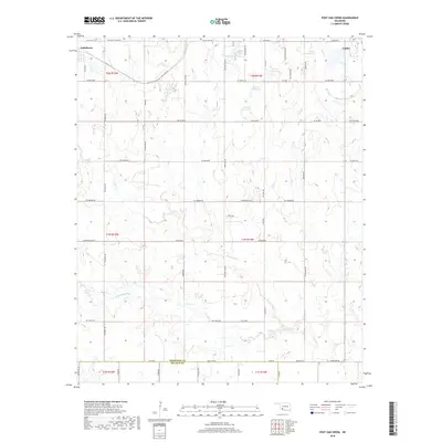
2018 Map of Post Oak Creek
USGS Topo · Published 2018About this map
The town of Cache and the settlement of Indiahoma anchor this section of Oklahoma’s southwestern plains, located just north of the Comanche Co Tillman Co border. The landscape is defined by the drainage network of Post Oak Cr and Little Post Oak Cr, which wind through the township sections toward the larger W Cache Cr. This 2018 survey reveals a rural infrastructure where historical section lines have been formalized into a precise grid of roads, such as SW Bandy Rd and SW Quanah Rd. Small agricultural settlements like Post Oak and Woodlawn persist as nodes within this expansive prairie landscape. A series of numbered water bodies, including 031018 Reservoir and 031021 Reservoir, highlight the critical role of water management in the region's ranching and farming operations.
Find a feature on this map
60 named features on this map. Tap any name to fly to it.
Don’t see what you’re looking for? This feature index may not catch every label — zoom into the map to look around manually.
Map Details
Editions of this 2018 Post Oak Creek Map
This is the sole edition of this map. No revisions or reprints were ever made.
Other maps of this area

1937 · Cache
USGS Topo · 1:48,000

1937 · Quanah Mountain
USGS Topo · 1:24,000

1942 · Cache
USGS Topo · 1:62,500

1949 · Mount Scott
USGS Topo · 1:24,000

1949 · Quanah Mountain
USGS Topo · 1:24,000

1950 · Snyder
USGS Topo · 1:62,500

1955 · Lawton
USGS Topo · 1:250,000

1956 · Post Oak Creek
USGS Topo · 1:24,000

1956 · Odetta
USGS Topo · 1:24,000
1956 · Quanah Mountain
USGS Topo · 1:24,000