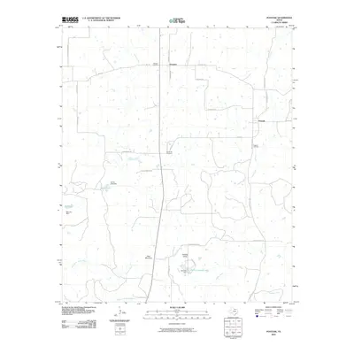
2010 Map of Postoak
USGS Topo · Published 2010About this map
The West Fork Trinity River winds through the southern portion of this landscape, anchoring a region of varied terrain and small, rural settlements. North of the river, the landscape rises toward Bear Mountain and the distinct lowlands of Pudding Valley, creating a topographically diverse area defined by its watercourses. Water management is a key feature here, with multiple impoundments including Garner Lake, Ball Lake, and Harry Campsey Lake scattered across the countryside.
Find a feature on this map
35 named features on this map. Tap any name to fly to it.
Don’t see what you’re looking for? This feature index may not catch every label — zoom into the map to look around manually.
Map Details
Editions of this 2010 Postoak Map
This is the sole edition of this map. No revisions or reprints were ever made.
Other maps of this area

1954 · Wichita Falls
USGS Topo · 1:250,000

1958 · Wichita Falls
USGS Topo · 1:250,000

1962 · Antelope Creek NE
USGS Topo · 1:24,000
1963 · Vashti
USGS Topo · 1:24,000

1964 · Cundiff
USGS Topo · 1:24,000

1964 · Johnson Lake
USGS Topo · 1:24,000

1964 · Lynn Creek
USGS Topo · 1:24,000
1964 · Newport
USGS Topo · 1:24,000

1964 · Antelope
USGS Topo · 1:24,000

1964 · Scotland SE
USGS Topo · 1:24,000