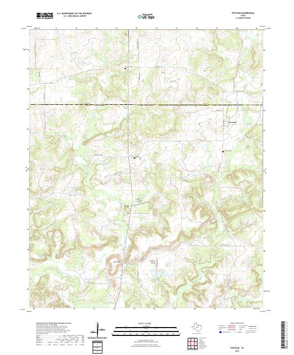
2022 Map of Postoak
USGS Topo · Published 2022About this map
The border between Clay Co and Jack Co divides this North Texas landscape, where the settlement of Postoak sits near the headwaters of Jones Cr. This modern 2022 survey captures a rural environment defined by family-named landmarks and small aviation, notably the Flyin Armadillo Airport and Harry Campsey Lake. The terrain transitions from the elevations of Bear Mtn down into the broad Pudding Valley, eventually reaching the W Fork Trinity River in the south. Genealogists will find several burial grounds preserved in the records, including Post Oak Cem, Hill Cem, and Prospect Cem along the northern boundary. The local road network, featuring routes like Old Post Oak Rd and Puddin Valley Ln, reflects the area's continued reliance on its historical cattle-ranching and agricultural corridors.
Find a feature on this map
37 named features on this map. Tap any name to fly to it.
Don’t see what you’re looking for? This feature index may not catch every label — zoom into the map to look around manually.
Map Details
Editions of this 2022 Postoak Map
This is the sole edition of this map. No revisions or reprints were ever made.
Other maps of this area

1954 · Wichita Falls
USGS Topo · 1:250,000

1958 · Wichita Falls
USGS Topo · 1:250,000

1962 · Antelope Creek NE
USGS Topo · 1:24,000
1963 · Vashti
USGS Topo · 1:24,000

1964 · Cundiff
USGS Topo · 1:24,000

1964 · Johnson Lake
USGS Topo · 1:24,000

1964 · Lynn Creek
USGS Topo · 1:24,000
1964 · Newport
USGS Topo · 1:24,000

1964 · Antelope
USGS Topo · 1:24,000

1964 · Scotland SE
USGS Topo · 1:24,000