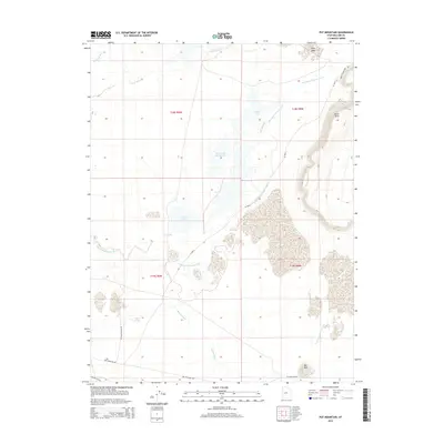
2014 Map of Pot Mountain
USGS Topo · Published 2014About this map
The Old Channel Sevier River and the Old River Bed wind through this Millard County landscape, revealing the ancient hydrological patterns of the Sevier Desert. The 2014 survey documents a complex system of seasonal water bodies and marshes, including the Swan Lake Salt Marsh and the clustered Carr Lake and Swan Lake. To the southeast, the terrain rises significantly at Black Rock and the isolated prominence of Pot Mtn. Modern access via Pot Mountain Rd and the Great Stone Face Rd provides passage through this arid region, while Jensen Spring serves as a notable water source in an otherwise dry environment. The convergence of the Sevier River and Beaver River drainages highlights the area's importance for local water management and desert ecology.
Find a feature on this map
20 named features on this map. Tap any name to fly to it.
Don’t see what you’re looking for? This feature index may not catch every label — zoom into the map to look around manually.
Map Details
Editions of this 2014 Pot Mountain Map
This is the sole edition of this map. No revisions or reprints were ever made.
Other maps of this area

1885 · Sevier Desert
USGS Topo · 1:250,000

1953 · Delta
USGS Topo · 1:250,000

1958 · Delta
USGS Topo · 1:250,000

1962 · Delta
USGS Topo · 1:250,000

1962 · Delta
USGS Topo · 1:62,500

1971 · Red Pass
USGS Topo · 1:24,000

1971 · Clay Knoll
USGS Topo · 1:24,000

1971 · Rocky Knoll
USGS Topo · 1:24,000

1971 · Neels
USGS Topo · 1:24,000

1971 · Sunstone Knoll
USGS Topo · 1:24,000