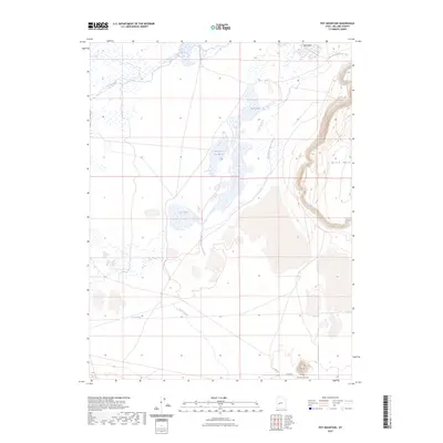
2023 Map of Pot Mountain
USGS Topo · Published 2023About this map
Swan Lake Salt Marsh and the surrounding wetlands dominate this landscape in Millard County, defining a complex hydrologic network where the Sevier River and Beaver River converge. The terrain is marked by the remnants of shifting watercourses, most notably the winding Old Channel Sevier River, which carves through the basin north of Carr Lake. These water bodies create a stark contrast with the prominent igneous and sedimentary elevations of Pot Mtn and the steep eastern face of Black Rock.
Find a feature on this map
12 named features on this map. Tap any name to fly to it.
Don’t see what you’re looking for? This feature index may not catch every label — zoom into the map to look around manually.
Map Details
Editions of this 2023 Pot Mountain Map
This is the sole edition of this map. No revisions or reprints were ever made.
Other maps of this area

1885 · Sevier Desert
USGS Topo · 1:250,000

1953 · Delta
USGS Topo · 1:250,000

1958 · Delta
USGS Topo · 1:250,000

1962 · Delta
USGS Topo · 1:250,000

1962 · Delta
USGS Topo · 1:62,500

1971 · Red Pass
USGS Topo · 1:24,000

1971 · Clay Knoll
USGS Topo · 1:24,000

1971 · Rocky Knoll
USGS Topo · 1:24,000

1971 · Neels
USGS Topo · 1:24,000

1971 · Sunstone Knoll
USGS Topo · 1:24,000