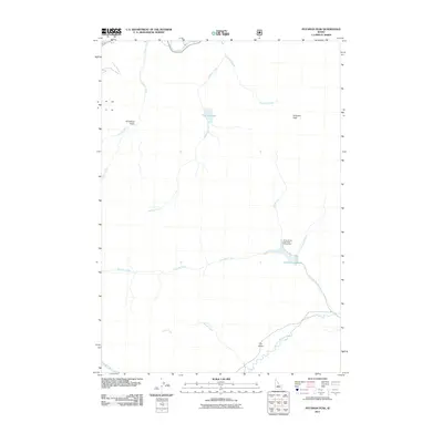
2011 Map of Potaman Peak
USGS Topo · Published 2011About this map
Potaman Peak stands as the central landmark in this high-altitude drainage basin within Custer County, Idaho. The landscape is defined by the complex network of waterways that feed into the Salmon River and the East Fork Salmon River, which cut through the northern and southern edges of the map respectively. Significant natural catchments like Sullivan Lake and Jimmy Smith Lake are central to the local geography, with the latter specifically designated as the Jimmy Smith Lake Public Fishing Area. This remote region is characterized by steep drainages including O'Calkens Gulch and Dry Gulch, which guide the flow of seasonal and perennial streams like Pistol Creek and Bluett Creek. The absence of major settlements highlights the area's role as a managed natural resource and recreation zone at the start of the 2010s.
Find a feature on this map
18 named features on this map. Tap any name to fly to it.
Don’t see what you’re looking for? This feature index may not catch every label — zoom into the map to look around manually.
Map Details
Editions of this 2011 Potaman Peak Map
This is the sole edition of this map. No revisions or reprints were ever made.
Other maps of this area

1919 · Custer
USGS Topo · 1:125,000

1922 · Custer
USGS Topo · 1:125,000

1929 · Bayhorse
USGS Topo · 1:125,000

1957 · Challis
USGS Topo · 1:250,000

1960 · Challis
USGS Topo · 1:250,000

1963 · Challis
USGS Topo · 1:250,000

1963 · Bald Mountain
USGS Topo · 1:24,000

1963 · Clayton
USGS Topo · 1:24,000
1963 · Ziegler Basin
USGS Topo · 1:24,000
1963 · Bowery Peak
USGS Topo · 1:24,000