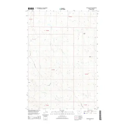
2014 Map of Potato Buttes
USGS Topo · Published 2014About this map
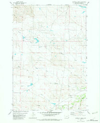
Potato Buttes rise above a landscape defined by an intricate network of seasonal drainages in this southeastern Montana survey. The high ground of the Flattops provides a stark contrast to the winding path of L O Creek and its many tributaries, including E Fork L O Cr and Deep Cr. This area of Carter County is characterized by a sprawling ranching infrastructure, where remote access is maintained via the Cottonwood Creek Rd and the Tauck Spur Rd. The drainage patterns, such as those of S Butte Cr and N Cottonwood Cr, reveal the underlying geological structure of the region, illustrating how water has shaped the terrain around these prominent butte formations. The map provides a precise look at the land partitions and natural landmarks used by generations of locals for navigation in the open country.
Find a feature on this map
18 named features on this map. Tap any name to fly to it.
Don’t see what you’re looking for? This feature index may not catch every label — zoom into the map to look around manually.
Map Details
Editions of this 2014 Potato Buttes Map
This is the sole edition of this map. No revisions or reprints were ever made.
Other maps of this area

1954 · Ekalaka
USGS Topo · 1:250,000

1956 · Ekalaka
USGS Topo · 1:250,000

1958 · Ekalaka
USGS Topo · 1:250,000

1965 · Ekalaka
USGS Topo · 1:250,000

1980 · Prairie Dog Creek
USGS Topo · 1:24,000
1980 · Alzada NW
USGS Topo · 1:24,000
1980 · Finger Buttes West
USGS Topo · 1:24,000

1981 · Alzada
USGS Topo · 1:100,000
1982 · Black Point NE
USGS Topo · 1:24,000
1982 · Whitetail Creek
USGS Topo · 1:24,000