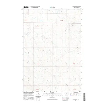
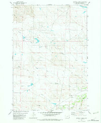
2017 Map of Potato Buttes
USGS Topo · Published 2017About this map
Potato Buttes and the elevated Flattops define this section of Carter County, Montana, where the high plains transition into complex drainage systems. The landscape is carved by numerous seasonal watercourses, including L O Cr, Deep Cr, and Trail Cr, which navigate the varying elevations of the Public Land Survey System townships. This 2017 U.S. Geological Survey representation highlights the remote character of the region, where human infrastructure is largely limited to thoroughfares like Cottonwood Rd. The map illustrates a classic Montana rangeland pattern, where the topography dictates the path of local creeks such as S Butte Cr and N Cottonwood Cr. For those studying the geography of eastern Montana, the detailed contour intervals provide a clear view of how these buttes and creek forks organize the local terrain.
Find a feature on this map
18 named features on this map. Tap any name to fly to it.
Don’t see what you’re looking for? This feature index may not catch every label — zoom into the map to look around manually.
Map Details
Editions of this 2017 Potato Buttes Map
This is the sole edition of this map. No revisions or reprints were ever made.
Other maps of this area

1954 · Ekalaka
USGS Topo · 1:250,000

1956 · Ekalaka
USGS Topo · 1:250,000

1958 · Ekalaka
USGS Topo · 1:250,000

1965 · Ekalaka
USGS Topo · 1:250,000

1980 · Prairie Dog Creek
USGS Topo · 1:24,000
1980 · Alzada NW
USGS Topo · 1:24,000
1980 · Finger Buttes West
USGS Topo · 1:24,000

1981 · Alzada
USGS Topo · 1:100,000
1982 · Black Point NE
USGS Topo · 1:24,000
1982 · Whitetail Creek
USGS Topo · 1:24,000