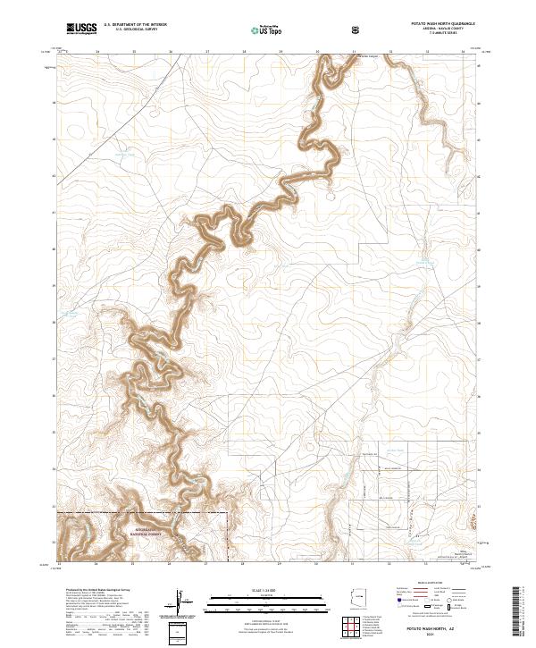
2021 Map of Potato Wash North
USGS Topo · Published 2021About this map
Chevelon Canyon carves a deep, winding path through the heart of this Navajo County landscape, defining the northern reaches of the Sitgreaves National Forest. This high-desert terrain is marked by a complex system of drainage and water management essential for ranching and aviation, notably at the Wisky Ranch/Chevlon Airport. The map documents a network of named stock tanks, including Little Antelope Tank, Trap Tank, and Horse Pasture Tank, which are scattered across the plateau above the canyon walls. In the southern sections, the topography transitions into the distinct drainages of Sandy Draw and Wildcat Canyon. Remote access is maintained through a series of named desert routes such as Southwell Rd and Willie Wonka Rd, serving the isolated ranch lands and forest boundaries.
Find a feature on this map
26 named features on this map. Tap any name to fly to it.
Don’t see what you’re looking for? This feature index may not catch every label — zoom into the map to look around manually.
Map Details
Editions of this 2021 Potato Wash North Map
This is the sole edition of this map. No revisions or reprints were ever made.
Other maps of this area

1886 · Holbrook
USGS Topo · 1:250,000

1893 · Holbrook
USGS Topo · 1:250,000

1954 · Holbrook
USGS Topo · 1:250,000

1955 · Sunset Knoll 2 SE
USGS Topo · 1:24,000

1955 · Sunset Pass
USGS Topo · 1:62,500

1957 · Holbrook
USGS Topo · 1:250,000

1958 · Holbrook
USGS Topo · 1:250,000

1960 · Holbrook
USGS Topo · 1:250,000

1965 · Chevelon Crossing
USGS Topo · 1:24,000

1970 · Red Knoll
USGS Topo · 1:24,000