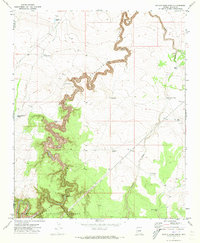
1971 Map of Potato Wash North
USGS Topo · Published 1973About this map
Chevelon Canyon carves a deep, serpentine path through the landscape, defining the topography of this high-plateau region of Navajo County in the early 1970s. The map illustrates a complex network of water management features essential for ranching and forest operations, including numerous named stock tanks such as Durant Tank, Archie Tank, and Horse Pasture Tank. This intricate system of basins is supplemented by the Mitchell Windmill and a specialized Gaging Station located near the confluence with Wildcat Canyon.
Find a feature on this map
19 named features on this map. Tap any name to fly to it.
Don’t see what you’re looking for? This feature index may not catch every label — zoom into the map to look around manually.
Map Details
Editions of this 1971 Potato Wash North Map
This is the sole edition of this map. No revisions or reprints were ever made.
Other maps of this area

1886 · Holbrook
USGS Topo · 1:250,000

1893 · Holbrook
USGS Topo · 1:250,000

1954 · Holbrook
USGS Topo · 1:250,000

1955 · Sunset Knoll 2 SE
USGS Topo · 1:24,000

1955 · Sunset Pass
USGS Topo · 1:62,500

1957 · Holbrook
USGS Topo · 1:250,000

1958 · Holbrook
USGS Topo · 1:250,000

1960 · Holbrook
USGS Topo · 1:250,000

1965 · Chevelon Crossing
USGS Topo · 1:24,000

1970 · Red Knoll
USGS Topo · 1:24,000