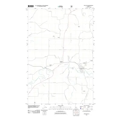
2011 Map of Potlatch
USGS Topo · Published 2011About this map
The Palouse River winds through this landscape in Latah County, anchoring the primary settlements of Potlatch and Onaway. In the early 21st century, this area remains a significant intersection of transport and geography, where Deep Creek and several smaller tributaries like Flannigan Creek and Gnat Creek feed the main river valley. The map reveals a high density of rural roads and land markers that point to a deep-rooted local history, including the namesake town’s industrial and railroad connections at Potlatch Junction.
Find a feature on this map
49 named features on this map. Tap any name to fly to it.
Don’t see what you’re looking for? This feature index may not catch every label — zoom into the map to look around manually.
Map Details
Editions of this 2011 Potlatch Map
This is the sole edition of this map. No revisions or reprints were ever made.
Other maps of this area

1903 · Oakesdale
USGS Topo · 1:125,000

1905 · Oakesdale
USGS Topo · 1:125,000

1910 · Pullman
USGS Topo · 1:125,000

1955 · Pullman
USGS Topo · 1:250,000

1955 · Spokane
USGS Topo · 1:250,000

1957 · Tensed
USGS Topo · 1:62,500

1958 · Spokane
USGS Topo · 1:250,000

1958 · Pullman
USGS Topo · 1:250,000

1960 · Robinson Lake
USGS Topo · 1:24,000

1960 · Moscow Mtn
USGS Topo · 1:24,000