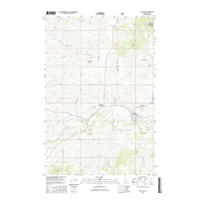
2017 Map of Potlatch
USGS Topo · Published 2017About this map
Potlatch and neighboring Onaway serve as the primary population centers in this northern Idaho landscape, where the Palouse River winds through a complex network of timber and agricultural land. The map illustrates the transition from the rolling hills of the Palouse to the edges of the St. Joe National Forest in the northeast. Transportation is anchored by the convergence of routes at Potlatch Junction, while a dense grid of rural roads like Kennedy Ford Rd and Flannigan Creek Rd connect outlying farmsteads and timber tracts. Local history is anchored by several sites of interment, including Freeze Cem, Mendenhall Cem, and Rock Creek Cem, which sit near the forks of E Fork Rock Cr and W Fork Rock Cr. The terrain is punctuated by distinctive high points such as Ball Butte and Farber Point, overlooking the drainages of Deep Cr and Gnat Cr.
Find a feature on this map
60 named features on this map. Tap any name to fly to it.
Don’t see what you’re looking for? This feature index may not catch every label — zoom into the map to look around manually.
Map Details
Editions of this 2017 Potlatch Map
This is the sole edition of this map. No revisions or reprints were ever made.
Other maps of this area

1903 · Oakesdale
USGS Topo · 1:125,000

1905 · Oakesdale
USGS Topo · 1:125,000

1910 · Pullman
USGS Topo · 1:125,000

1955 · Pullman
USGS Topo · 1:250,000

1955 · Spokane
USGS Topo · 1:250,000

1957 · Tensed
USGS Topo · 1:62,500

1958 · Spokane
USGS Topo · 1:250,000

1958 · Pullman
USGS Topo · 1:250,000

1960 · Robinson Lake
USGS Topo · 1:24,000

1960 · Moscow Mtn
USGS Topo · 1:24,000