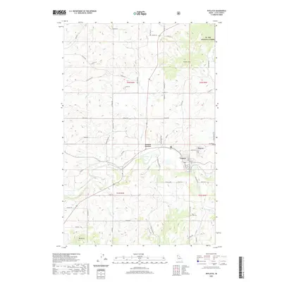
2020 Map of Potlatch
USGS Topo · Published 2020About this map
The Palouse River winds through the heart of Latah County, serving as the geographic anchor for the timber and agricultural communities of Potlatch and Onaway. In this corner of Idaho, the terrain shifts from the managed lands of the St Joe National Forest in the northeast to the productive river valley. The map reveals a high concentration of local family history markers, including Freeze Cem, Rock Creek Cem, and Mendenhall Cem, which are situated along a network of rural routes like Garfield Rd and Onaway Rd. Elevations range from the river flats to prominent heights such as Farber Point and Ball Butte, illustrating the rugged topography that defined the area's development. Transportation patterns are centered on Potlatch Junction, where the convergence of road and rail once facilitated the region's prominent lumber industry.
Find a feature on this map
58 named features on this map. Tap any name to fly to it.
Don’t see what you’re looking for? This feature index may not catch every label — zoom into the map to look around manually.
Map Details
Editions of this 2020 Potlatch Map
This is the sole edition of this map. No revisions or reprints were ever made.
Other maps of this area

1903 · Oakesdale
USGS Topo · 1:125,000

1905 · Oakesdale
USGS Topo · 1:125,000

1910 · Pullman
USGS Topo · 1:125,000

1955 · Pullman
USGS Topo · 1:250,000

1955 · Spokane
USGS Topo · 1:250,000

1957 · Tensed
USGS Topo · 1:62,500

1958 · Spokane
USGS Topo · 1:250,000

1958 · Pullman
USGS Topo · 1:250,000

1960 · Robinson Lake
USGS Topo · 1:24,000

1960 · Moscow Mtn
USGS Topo · 1:24,000