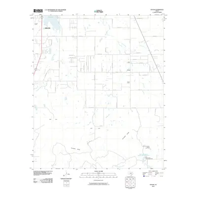
2010 Map of Potosi
USGS Topo · Published 2010About this map
Potosi sits at the heart of this landscape, characterized by the transition from the expanding outskirts of Abilene to the rugged southern terrain of the Callahan Divide. In the north, Kirby Lake and Flying W Airport serve as major landmarks near the suburban fringe, while the unincorporated community of Potosi is anchored by its local institutions, specifically the Potosi School and Potosi Cemetery.
Find a feature on this map
57 named features on this map. Tap any name to fly to it.
Don’t see what you’re looking for? This feature index may not catch every label — zoom into the map to look around manually.
Map Details
Editions of this 2010 Potosi Map
This is the sole edition of this map. No revisions or reprints were ever made.
Other maps of this area

1890 · Abilene
USGS Topo · 1:125,000

1892 · Abilene
USGS Topo · 1:125,000

1954 · Abilene
USGS Topo · 1:250,000

1957 · Kirby Lake
USGS Topo · 1:62,500

1957 · Abilene West
USGS Topo · 1:24,000

1957 · Abilene East
USGS Topo · 1:24,000

1957 · Buffalo Gap
USGS Topo · 1:62,500

1958 · Abilene
USGS Topo · 1:250,000

1967 · Tuscola
USGS Topo · 1:24,000
1967 · Lawn
USGS Topo · 1:24,000