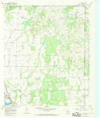
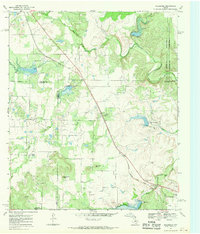
1967 Map of Lawn
USGS Topo · Published 1970About this map
Lawn sits at the southwestern edge of this West Texas survey, serving as a focal point for the surrounding rural landscape where the A T And S F railroad cuts through the terrain. The presence of an Oil Field and a Drive-in Theater near the town center reflects a mid-century community balancing traditional ranching or agricultural life with industrial interests and modern entertainment. To the north and east, the land is etched by a complex drainage network including Jim Ned Creek, Twomile Creek, and South Pecan Bayou.
Find a feature on this map
19 named features on this map. Tap any name to fly to it.
Don’t see what you’re looking for? This feature index may not catch every label — zoom into the map to look around manually.
Map Details
Editions of this 1967 Lawn Map
2 editions found
Other maps of this area

1890 · Abilene
USGS Topo · 1:125,000

1892 · Abilene
USGS Topo · 1:125,000

1954 · Abilene
USGS Topo · 1:250,000

1957 · Kirby Lake
USGS Topo · 1:62,500

1957 · Buffalo Gap
USGS Topo · 1:62,500

1958 · Abilene
USGS Topo · 1:250,000

1967 · Tuscola
USGS Topo · 1:24,000
1967 · McEwen Draw
USGS Topo · 1:24,000
1967 · Oplin
USGS Topo · 1:24,000
1967 · Goldsboro
USGS Topo · 1:24,000