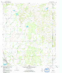
1967 Map of Lawn
USGS Topo · Published 1991About this map
Lawn sits at the intersection of local commerce and mid-century recreation in this late 1960s landscape along the Taylor and Callahan county line. The settlement pattern is defined by the proximity to Jim Ned Creek and Santa Fe Lake, while cultural landmarks like the Drive-in Theater near the town center reflect the era's social life. The terrain is marked by significant hydrological features, including the South Pecan Bayou and Prong in the northeast, transitioning into a network of drainages like Twomile Creek and Gray Branch.
Find a feature on this map
18 named features on this map. Tap any name to fly to it.
Don’t see what you’re looking for? This feature index may not catch every label — zoom into the map to look around manually.
Map Details
Editions of this 1967 Lawn Map
2 editions found
Other maps of this area

1890 · Abilene
USGS Topo · 1:125,000

1892 · Abilene
USGS Topo · 1:125,000

1954 · Abilene
USGS Topo · 1:250,000

1957 · Kirby Lake
USGS Topo · 1:62,500

1957 · Buffalo Gap
USGS Topo · 1:62,500

1958 · Abilene
USGS Topo · 1:250,000

1967 · Tuscola
USGS Topo · 1:24,000
1967 · McEwen Draw
USGS Topo · 1:24,000
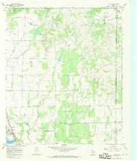
1967 · Lawn
USGS Topo · 1:24,000
1967 · Oplin
USGS Topo · 1:24,000