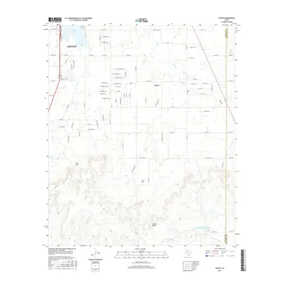
2016 Map of Potosi
USGS Topo · Published 2016About this map
Potosi and the southeastern edge of Abilene dominate this 2016 survey, where the suburban transition meets the complex terrain of the Callahan Divide. This area is defined by a series of low canyons and recesses, most notably Bear Cove and Lytle Cove, which drain northward through seasonal streams like Cedar Creek and Lytle Creek. In the north, Kirby Lake serves as a significant landmark near the Kirby Dam, while the landscape further south and east transitions into more agricultural and open land along the Taylor and Callahan county line.
Find a feature on this map
80 named features on this map. Tap any name to fly to it.
Don’t see what you’re looking for? This feature index may not catch every label — zoom into the map to look around manually.
Map Details
Editions of this 2016 Potosi Map
This is the sole edition of this map. No revisions or reprints were ever made.
Other maps of this area

1890 · Abilene
USGS Topo · 1:125,000

1892 · Abilene
USGS Topo · 1:125,000

1954 · Abilene
USGS Topo · 1:250,000

1957 · Kirby Lake
USGS Topo · 1:62,500

1957 · Abilene West
USGS Topo · 1:24,000

1957 · Abilene East
USGS Topo · 1:24,000

1957 · Buffalo Gap
USGS Topo · 1:62,500

1958 · Abilene
USGS Topo · 1:250,000

1967 · Tuscola
USGS Topo · 1:24,000
1967 · Lawn
USGS Topo · 1:24,000