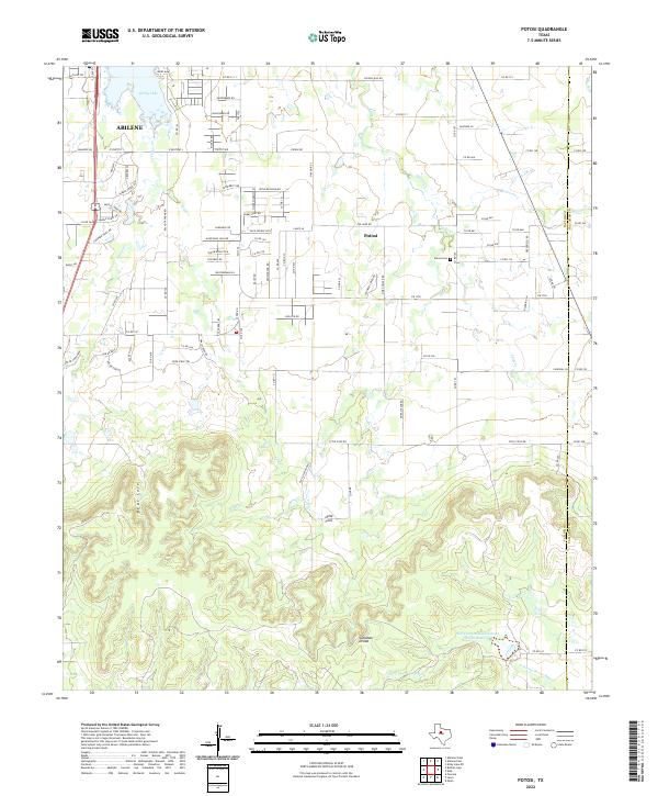
2022 Map of Potosi
USGS Topo · Published 2022About this map
Abilene anchors the northwestern corner of this Texas landscape, where suburban expansion meets the distinct geography of the Callahan Divide. The settlement of Potosi serves as a central hub, surrounded by a dense network of county roads like Hog Eye Rd and Idle Creek Trl that navigate the transitional terrain between the city and the southern uplands. Significant water management is evident throughout the quadrangle, from the large Kirby Lake and its associated Kirby Dam to the Soil Conservation Service Site 4a Reservoir located near the headwaters of the S Prong Pecan Bayou. These features illustrate the region's reliance on engineered water solutions in a landscape characterized by deep coves such as Bear Cove and Lytle Cove. For those tracing local heritage, the Potosi Cem remains a primary landmark within the community, while the Taylor Co and Callahan Co border defines the eastern edge of the survey.
Find a feature on this map
99 named features on this map. Tap any name to fly to it.
Don’t see what you’re looking for? This feature index may not catch every label — zoom into the map to look around manually.
Map Details
Editions of this 2022 Potosi Map
This is the sole edition of this map. No revisions or reprints were ever made.
Other maps of this area

1890 · Abilene
USGS Topo · 1:125,000

1892 · Abilene
USGS Topo · 1:125,000

1954 · Abilene
USGS Topo · 1:250,000

1957 · Kirby Lake
USGS Topo · 1:62,500

1957 · Abilene West
USGS Topo · 1:24,000

1957 · Abilene East
USGS Topo · 1:24,000

1957 · Buffalo Gap
USGS Topo · 1:62,500

1958 · Abilene
USGS Topo · 1:250,000

1967 · Tuscola
USGS Topo · 1:24,000
1967 · Lawn
USGS Topo · 1:24,000