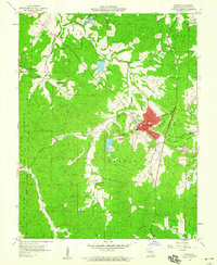
1958 Map of Potosi
USGS Topo · Published 1959About this map
The lead-mining heritage of Washington County is etched into the landscape of Potosi and Springtown during the late 1950s. The dense concentration of Mines and Tailings Ponds along Mine Breton Creek and Rubeneau Br underscores the extractive industry that historically drove the local economy. The town of Potosi serves as a hub, complete with its High Sch, County Fairground, and the Missouri Pacific railroad line providing critical transport links through the river valleys.
Find a feature on this map
35 named features on this map. Tap any name to fly to it.
Don’t see what you’re looking for? This feature index may not catch every label — zoom into the map to look around manually.
Map Details
Editions of this 1958 Potosi Map
3 editions found
Other maps of this area

1901 · De Soto
USGS Topo · 1:125,000

1905 · Bonneterre
USGS Topo · 1:62,500

1906 · Potosi
USGS Topo · 1:62,500

1937 · Tiff
USGS Topo · 1:24,000

1939 · Tiff
USGS Topo · 1:24,000

1946 · Richwoods
USGS Topo · 1:62,500

1948 · Richwoods
USGS Topo · 1:62,500

1949 · Saint Louis
USGS Topo · 1:250,000

1949 · Rolla
USGS Topo · 1:250,000

1953 · Rolla
USGS Topo · 1:250,000