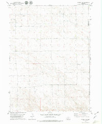
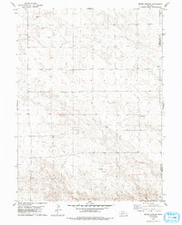
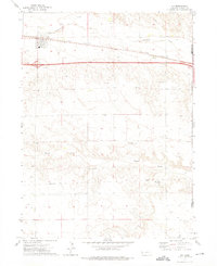
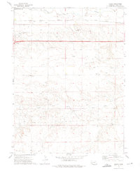
1979 Map of Potter 2 SW
USGS Topo · Published 1979About this map
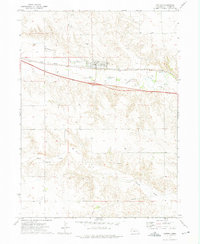
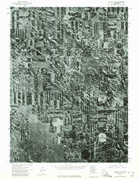
The High Plains landscape of the Nebraska panhandle defines this 1970s survey, straddling the Kimball Co and Cheyenne Co boundary. The area is characterized by an extensive Oil Field, with numerous scattered Oil Wells and a central Well marking the energy production of the era. The terrain shows a transition from the flatter uplands down into the rolling drainage patterns common to this part of the state. Cultural development is sparse, with Bethel Cem serving as a significant genealogical marker for the local rural community. This map records the footprint of the mid-century petroleum industry on the agricultural plains before further modern infrastructure expansion.
Find a feature on this map
6 named features on this map. Tap any name to fly to it.
Don’t see what you’re looking for? This feature index may not catch every label — zoom into the map to look around manually.
Map Details
Editions of this 1979 Potter 2 SW Map
2 editions found
Other maps of this area

1954 · Scottsbluff
USGS Topo · 1:250,000

1958 · Scottsbluff
USGS Topo · 1:250,000
1972 · Dix
USGS Topo · 1:24,000
1972 · Owasco
USGS Topo · 1:24,000
1972 · Potter
USGS Topo · 1:24,000
1973 · Potter 2 SW
USGS Topo · 1:24,000
1973 · Kimball 1 SE
USGS Topo · 1:24,000
1973 · Kimball 1 NE
USGS Topo · 1:24,000
1973 · Potter 2 SE
USGS Topo · 1:24,000
1973 · Potter 2 NW
USGS Topo · 1:24,000