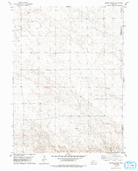
1979 Map of Bethel Cemetery
USGS Topo · Published 1993About this map
The High Plains landscape along the border of Kimball and Cheyenne counties reveals a mid-century energy landscape dominated by petroleum extraction. The terrain is characterized by a dense network of unimproved roads and section lines connecting numerous scattered Oil Wells and a broader Oil Field. While the industrial footprint is significant, a small pocket of local history remains at Bethel Cem, located in the southeastern portion of the quadrangle. This 1970s topographic study captures the area during a period of active resource development, illustrating how energy infrastructure was integrated into the existing grid of the Nebraska panhandle. The map serves as a detailed record for those researching the evolution of the regional economy or tracing family heritage near the historic cemetery site.
Find a feature on this map
6 named features on this map. Tap any name to fly to it.
Don’t see what you’re looking for? This feature index may not catch every label — zoom into the map to look around manually.
Map Details
Editions of this 1979 Bethel Cemetery Map
2 editions found
Other maps of this area

1954 · Scottsbluff
USGS Topo · 1:250,000

1958 · Scottsbluff
USGS Topo · 1:250,000

1972 · Dix
USGS Topo · 1:24,000

1972 · Owasco
USGS Topo · 1:24,000

1972 · Potter
USGS Topo · 1:24,000

1973 · Potter 2 SW
USGS Topo · 1:24,000

1973 · Kimball 1 SE
USGS Topo · 1:24,000

1973 · Kimball 1 NE
USGS Topo · 1:24,000

1973 · Potter 2 SE
USGS Topo · 1:24,000

1973 · Potter 2 NW
USGS Topo · 1:24,000