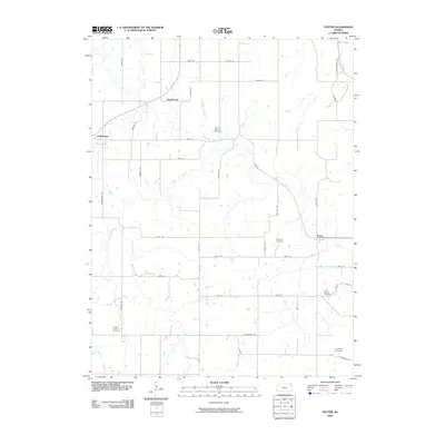
2009 Map of Potter
USGS Topo · Published 2009About this map
Potter and Cummings anchor this 2009 survey of eastern Atchison County, where the landscape is defined by the winding course of Stranger Creek and its many tributaries. The area maintains a traditional agricultural grid, with settlements like Hawthorne connected by a network of established local roads. Genealogists and local historians will find several well-preserved burial grounds across the township, including Round Mound Cemetery and Fairview Cemetery near the center of the map, as well as Saint Johns Cemetery, Corpus Christi Cemetery, and Evergreen Cemetery situated near the southern and eastern borders. The complex drainage system of Crooked Creek, Camp Creek, and Mooney Creek illustrates the undulating terrain that shapes the farmsteads in this part of Kansas, while Walnut Creek cuts through the northeastern corner.
Find a feature on this map
49 named features on this map. Tap any name to fly to it.
Don’t see what you’re looking for? This feature index may not catch every label — zoom into the map to look around manually.
Map Details
Editions of this 2009 Potter Map
This is the sole edition of this map. No revisions or reprints were ever made.
Other maps of this area

1885 · Atchison
USGS Topo · 1:125,000

1886 · Oskaloosa
USGS Topo · 1:125,000

1888 · Oskaloosa
USGS Topo · 1:125,000

1888 · Atchison
USGS Topo · 1:125,000

1893 · Atchison
USGS Topo · 1:125,000

1894 · Oskaloosa
USGS Topo · 1:125,000

1926 · Atchison
USGS Topo · 1:62,500

1948 · Oak Mills
USGS Topo · 1:24,000

1950 · Kansas City
USGS Topo · 1:250,000

1950 · Easton
USGS Topo · 1:24,000