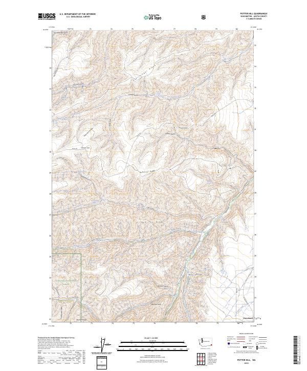
2023 Map of Potter Hill
USGS Topo · Published 2023About this map
Cloverland sits at the edge of a deeply incised landscape where the high plateaus of Asotin County drop into a complex network of canyons and ridges. This modern survey reveals the persistent agricultural and ranching patterns of the region, anchored by landforms like Potter Hill and Rubenser Ridge. The southern portion of the map is defined by the Umatilla National Forest, where the terrain becomes increasingly complex around Bracken Ridge and the drainages of the South Fork Asotin Creek. Numerous water sources, such as Schuelke Spring and Cottonwood Spring, point to the vital importance of water management in this dry, high-elevation environment. The naming conventions, including Pow-Wah-Kee Gulch and Tam Tam Ridge, reflect the deep cultural history of the area, while roads like Peola Rd and Campbell Grade Rd trace the winding paths necessitated by the dramatic shifts in elevation.
Find a feature on this map
48 named features on this map. Tap any name to fly to it.
Don’t see what you’re looking for? This feature index may not catch every label — zoom into the map to look around manually.
Map Details
Editions of this 2023 Potter Hill Map
This is the sole edition of this map. No revisions or reprints were ever made.
Other maps of this area

1943 · Peola
USGS Topo · 1:62,500

1943 · Saddle Butte
USGS Topo · 1:62,500

1944 · Anatone
USGS Topo · 1:62,500

1945 · Clarkston
USGS Topo · 1:62,500

1946 · Saddle Butte
USGS Topo · 1:62,500

1946 · Peola
USGS Topo · 1:62,500

1946 · Anatone
USGS Topo · 1:62,500

1948 · Clarkston
USGS Topo · 1:62,500

1955 · Pullman
USGS Topo · 1:250,000

1958 · Pullman
USGS Topo · 1:250,000