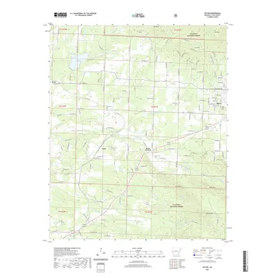
2020 Map of Potter
USGS Topo · Published 2020About this map
Ouachita National Forest blankets the southern and northern reaches of this Polk County terrain, where the mountain foothills meet the growing western edge of Mena. The landscape is a network of small family-named settlements and rural cemeteries that trace the genealogy of the region, including Potter, Potter Junction, and Rocky. Water plays a central role in the local geography, from the recreational waters of Lake Wilhelmina to the winding courses of Mountain Fork and McKinney Creek. The transition from the dense timberlands of Potter Mountain and Blowout Mountain to the residential streets of Mena's western neighborhoods reveals the balance between wilderness and civic growth. Genealogists will find several burial sites mapped, such as Oak Grove Cemetery and the more remote Gann Cemetery, reflecting generations of settlement in the Ouachita Mountains.
Find a feature on this map
144 named features on this map. Tap any name to fly to it.
Don’t see what you’re looking for? This feature index may not catch every label — zoom into the map to look around manually.
Map Details
Editions of this 2020 Potter Map
This is the sole edition of this map. No revisions or reprints were ever made.
Other maps of this area

1890 · Poteau Mountain
USGS Topo · 1:125,000

1899 · Poteau Mountain
USGS Topo · 1:125,000

1913 · De Queen
USGS Topo · 1:125,000

1950 · Mcalester
USGS Topo · 1:250,000

1958 · Mena
USGS Topo · 1:62,500

1958 · Potter
USGS Topo · 1:62,500

1958 · Zafra
USGS Topo · 1:24,000

1958 · Mena
USGS Topo · 1:24,000

1958 · Rich Mountain
USGS Topo · 1:24,000
1958 · Potter
USGS Topo · 1:24,000