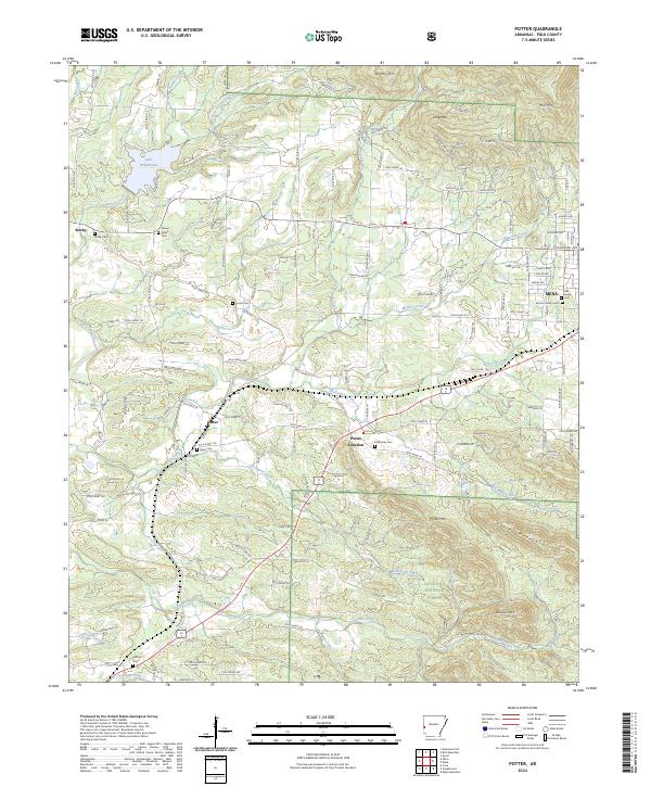
2024 Map of Potter
USGS Topo · Published 2024About this map
Lake Wilhelmina anchors the northwestern corner of this landscape, where the waters of Powell Creek and the East Fork Powell Creek are managed among the timbered ridges. To the south, the terrain transitions into the protected slopes of the Ouachita National Forest, dominated by the prominent peaks of Dallas Mountain and Potter Mtn. The settlement pattern follows the lower elevations between these mountains, with small communities like Potter, Potter Junction, and Rocky serving as local hubs for the surrounding rural roads.
Find a feature on this map
85 named features on this map. Tap any name to fly to it.
Don’t see what you’re looking for? This feature index may not catch every label — zoom into the map to look around manually.
Map Details
Editions of this 2024 Potter Map
This is the sole edition of this map. No revisions or reprints were ever made.
Other maps of this area

1890 · Poteau Mountain
USGS Topo · 1:125,000

1899 · Poteau Mountain
USGS Topo · 1:125,000

1913 · De Queen
USGS Topo · 1:125,000

1950 · Mcalester
USGS Topo · 1:250,000

1958 · Mena
USGS Topo · 1:62,500

1958 · Potter
USGS Topo · 1:62,500

1958 · Zafra
USGS Topo · 1:24,000

1958 · Mena
USGS Topo · 1:24,000

1958 · Rich Mountain
USGS Topo · 1:24,000
1958 · Potter
USGS Topo · 1:24,000