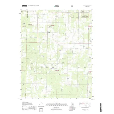
2017 Map of Pottersville
USGS Topo · Published 2017About this map
The small settlements of Pottersville, Cureall, and Crider anchor this portion of the Ozarks along the Ozark and Howell county line. The landscape is defined by a dense network of hollows, such as Butler Hollow, Sawmill Hollow, and Ramsey Hollow, which channel drainage into watercourses like Tabor Cr and Spring Cr. These topographic features historically dictated the placement of roads and homesteads, creating a scattered settlement pattern that persists today. Numerous cemeteries, including Union Grove General Baptist Cem, Setzer Cem, and Ledbetter Cem, are distributed across the area, often near crossroads or small drainage basins. Portions of the Mark Twain National Forest cover the northwest and northeast corners, where the terrain becomes particularly dissected near Low Gap and Rex Hill. This map reflects the enduring rural character of the region, where natural springs like Cureall Spring and Wilson Spring remain key landmarks in a territory shaped by the rugged topography of the southern Missouri plateau.
Find a feature on this map
94 named features on this map. Tap any name to fly to it.
Don’t see what you’re looking for? This feature index may not catch every label — zoom into the map to look around manually.
Map Details
Editions of this 2017 Pottersville Map
This is the sole edition of this map. No revisions or reprints were ever made.
Other maps of this area

1939 · Topaz
USGS Topo · 1:62,500

1941 · Topaz
USGS Topo · 1:62,500

1944 · West Plains
USGS Topo · 1:62,500

1944 · Cureall
USGS Topo · 1:62,500

1945 · Harrison
USGS Topo · 1:250,000

1945 · Willow Springs
USGS Topo · 1:62,500

1946 · West Plains
USGS Topo · 1:62,500

1946 · Cureall
USGS Topo · 1:62,500

1948 · Willow Springs
USGS Topo · 1:62,500

1949 · Harrison
USGS Topo · 1:250,000