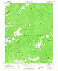
1966 Map of Potts Creek
USGS Topo · Published 1967About this map
Potts Creek flows through the central valley of this mid-1960s survey, marking a rugged borderland between Virginia and West Virginia. The landscape is dominated by the steep ridges of Peters Mountain and Potts Mountain, which hem in the narrow agricultural and forest lands of the Jefferson National Forest. This era shows a community rooted in its geographic landmarks and rural institutions, from the Paint Bank National Fish Hatchery in the west to the quiet clusters of Paxton Chapel and Mt Olivet Ch.
Find a feature on this map
58 named features on this map. Tap any name to fly to it.
Don’t see what you’re looking for? This feature index may not catch every label — zoom into the map to look around manually.
Map Details
Editions of this 1966 Potts Creek Map
2 editions found
Other maps of this area

1887 · Lewisburg
USGS Topo · 1:125,000

1890 · Christiansburg
USGS Topo · 1:125,000

1891 · Lewisburg
USGS Topo · 1:125,000

1921 · Ronceverte
USGS Topo · 1:48,000

1923 · Ronceverte
USGS Topo · 1:62,500

1923 · Waiteville
USGS Topo · 1:62,500

1929 · Salem
USGS Topo · 1:48,000

1931 · Waiteville
USGS Topo · 1:48,000

1932 · Salem
USGS Topo · 1:62,500

1944 · Waiteville
USGS Topo · 1:62,500