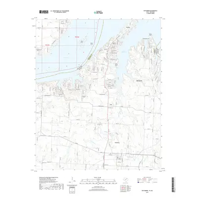
2019 Map of Pottsboro
USGS Topo · Published 2019About this map
Lake Texoma and its irregular shoreline dominate this landscape along the border of Texas and Oklahoma. The map documents the residential and recreational development surrounding Little Mineral Arm, where neighborhoods like those on Preston Peninsula and Grandpappy Point are etched into the terrain. Further south, the town of Pottsboro serves as a central hub, connected by a network of local roads and farm-to-market routes that lead toward the larger center of Denison.
Find a feature on this map
143 named features on this map. Tap any name to fly to it.
Don’t see what you’re looking for? This feature index may not catch every label — zoom into the map to look around manually.
Map Details
Editions of this 2019 Pottsboro Map
This is the sole edition of this map. No revisions or reprints were ever made.
Other maps of this area

1901 · Denison
USGS Topo · 1:125,000

1954 · Sherman
USGS Topo · 1:250,000

1957 · Denison Dam
USGS Topo · 1:24,000

1958 · Gordonville
USGS Topo · 1:62,500

1958 · Denison Dam
USGS Topo · 1:62,500

1958 · Sherman NW
USGS Topo · 1:24,000

1958 · Whitesboro
USGS Topo · 1:62,500

1958 · Sherman
USGS Topo · 1:250,000

1958 · Sherman
USGS Topo · 1:62,500

1958 · Sherman
USGS Topo · 1:24,000