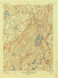
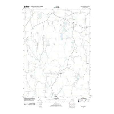
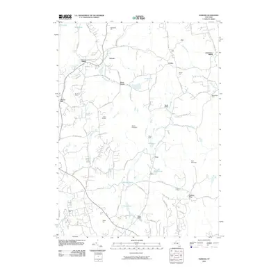
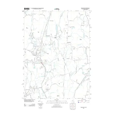
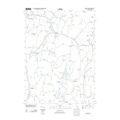
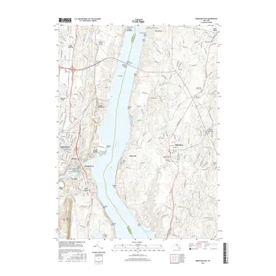
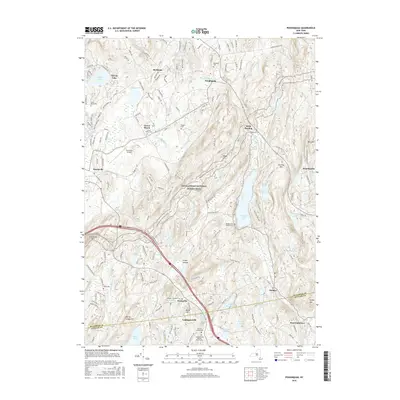
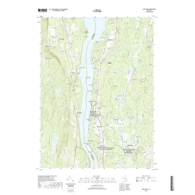
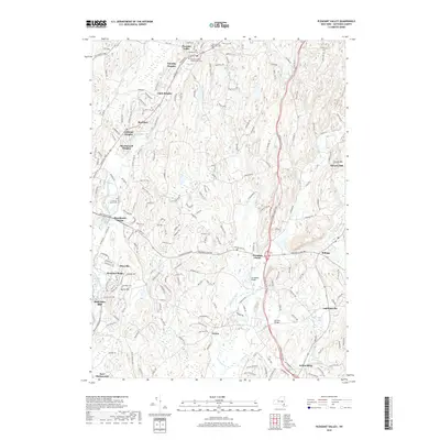
1948 Map of Poughquag
USGS Topo · Published 1948About this map
The hills and valleys of eastern Dutchess County are defined by a mix of institutional grounds, summer camps, and small railroad hamlets in this mid-century survey. A prominent landmark is the U S Disciplinary Barracks near Green Haven, situated just north of the New York New Haven and Hartford rail line. The landscape is dotted with seasonal recreation sites such as Camp Sanita on the shores of Whaley Lake and Camp Alamar further west, reflecting the area's development as a retreat from the city.
Find a feature on this map
51 named features on this map. Tap any name to fly to it.
Don’t see what you’re looking for? This feature index may not catch every label — zoom into the map to look around manually.
Map Details
Editions of this 1948 Poughquag Map
2 editions found
Historical Maps of East Fishkill Through Time
69 maps found

1893 Clove
Dutchess County, NY

1894 Clove
Dutchess County, NY

1898 Clove
Dutchess County, NY

1898 Rhinebeck
Dutchess County, NY

1901 Clove
Dutchess County, NY

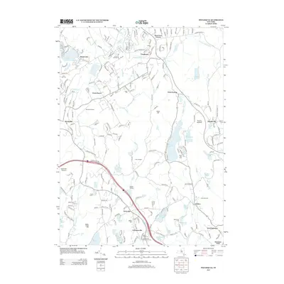
1934 Rhinebeck
Dutchess County, NY

1939 Rhinebeck
Dutchess County, NY

1945 Pawling
Dutchess County, NY

1946 Verbank
Dutchess County, NY

1947 Pawling
Dutchess County, NY

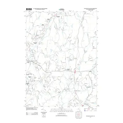
1947 Wappinger Falls
Dutchess County, NY

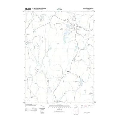
1948 Pine Plains
Dutchess County, NY

1948 Poughquag
Dutchess County, NY

1957 Pleasant Valley
Dutchess County, NY

1958 Amenia
Dutchess County, NY

1958 Pawling
Dutchess County, NY

1960 Pine Plains
Dutchess County, NY

1960 Poughquag
Dutchess County, NY

1960 Verbank
Dutchess County, NY

1963 Hyde Park
Dutchess County, NY

1963 Kingston East
Dutchess County, NY

1963 Rock City
Dutchess County, NY

1980 Hyde Park
Dutchess County, NY

1998 Pawling
Dutchess County, NY

2010 Amenia
Dutchess County, NY
2010 Hyde Park
Dutchess County, NY
2010 Kingston East
Dutchess County, NY
2010 Pawling
Dutchess County, NY
2010 Pine Plains
Dutchess County, NY
2010 Pleasant Valley
Dutchess County, NY
2010 Poughquag
Dutchess County, NY
2010 Rock City
Dutchess County, NY
2010 Verbank
Dutchess County, NY
2013 Amenia
Dutchess County, NY
2013 Hyde Park
Dutchess County, NY
2013 Kingston East
Dutchess County, NY
2013 Pawling
Dutchess County, NY
2013 Pine Plains
Dutchess County, NY
2013 Pleasant Valley
Dutchess County, NY
2013 Poughquag
Dutchess County, NY
2013 Rock City
Dutchess County, NY
2013 Verbank
Dutchess County, NY
2016 Amenia
Dutchess County, NY
2016 Hyde Park
Dutchess County, NY
2016 Kingston East
Dutchess County, NY
2016 Pawling
Dutchess County, NY
2016 Pine Plains
Dutchess County, NY
2016 Pleasant Valley
Dutchess County, NY
2016 Poughquag
Dutchess County, NY
2016 Rock City
Dutchess County, NY
2016 Verbank
Dutchess County, NY
2019 Amenia
Dutchess County, NY
2019 Hyde Park
Dutchess County, NY
2019 Kingston East
Dutchess County, NY
2019 Pawling
Dutchess County, NY
2019 Pine Plains
Dutchess County, NY
2019 Pleasant Valley
Dutchess County, NY
2019 Poughquag
Dutchess County, NY
2019 Rock City
Dutchess County, NY
2019 Verbank
Dutchess County, NY

2023 Amenia
Dutchess County, NY

2023 Hyde Park
Dutchess County, NY

2023 Kingston East
Dutchess County, NY

2023 Pawling
Dutchess County, NY

2023 Pine Plains
Dutchess County, NY

2023 Pleasant Valley
Dutchess County, NY

2023 Poughquag
Dutchess County, NY

2023 Rock City
Dutchess County, NY

2023 Verbank
Dutchess County, NY