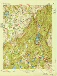
1948 Map of Poughquag
USGS Topo · Published 1948About this map
The hills and lowlands of the Dutchess and Putnam county border come alive in this post-war landscape, anchored by the significant Disciplinary Barracks at Green Haven. This high-security installation sits in the broad valley near Stormville, marking a period of intense institutional expansion in rural New York. To the east, the Appalachian Trail winds over the ridges of Noober Hill and through the valley floor, crossing paths with the New York New Haven and Hartford railroad line near Holmes.
Find a feature on this map
48 named features on this map. Tap any name to fly to it.
Don’t see what you’re looking for? This feature index may not catch every label — zoom into the map to look around manually.
Map Details
Editions of this 1948 Poughquag Map
2 editions found
Other maps of this area

1892 · West Point
USGS Topo · 1:62,500

1892 · Carmel
USGS Topo · 1:62,500

1893 · Carmel
USGS Topo · 1:62,500

1893 · Clove
USGS Topo · 1:62,500

1893 · Poughkeepsie
USGS Topo · 1:62,500

1894 · West Point
USGS Topo · 1:62,500

1894 · Clove
USGS Topo · 1:62,500

1894 · Carmel
USGS Topo · 1:62,500

1894 · Poughkeepsie
USGS Topo · 1:62,500

1898 · Clove
USGS Topo · 1:62,500