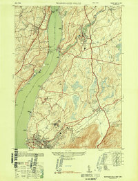
1947 Map of Wappinger Falls
USGS Topo · Published 1947About this map
The Hudson River serves as the central artery for this mid-century topographic portrait of Dutchess County, where industrial riverfronts meet rising highlands. To the south, the city of Beacon is depicted at a time when the Matteawan State Hospital and the US Veterans Hospital at Castle Point were prominent local institutions. The river itself is a focal point of commerce and navigation, marked by the Danskammer Light and the heavy rail traffic of the New York Central along its eastern bank.
Find a feature on this map
45 named features on this map. Tap any name to fly to it.
Don’t see what you’re looking for? This feature index may not catch every label — zoom into the map to look around manually.
Map Details
Editions of this 1947 Wappinger Falls Map
2 editions found
Other maps of this area

1892 · West Point
USGS Topo · 1:62,500

1893 · Poughkeepsie
USGS Topo · 1:62,500

1894 · West Point
USGS Topo · 1:62,500

1894 · Poughkeepsie
USGS Topo · 1:62,500

1899 · West Point
USGS Topo · 1:62,500

1901 · West Point
USGS Topo · 1:62,500

1902 · Schunemunk
USGS Topo · 1:62,500

1903 · Poughkeepsie
USGS Topo · 1:62,500

1903 · Newburg
USGS Topo · 1:62,500

1930 · Schunemunk
USGS Topo · 1:48,000