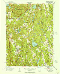
1951 Map of Pound Ridge
USGS Topo · Published 1956About this map
Pound Ridge Reservation dominates the northern reaches of this mid-century survey, its wooded hills and hollows like Honey Hollow and Wildcat Hollow standing in contrast to the maturing suburban developments of the New York-Connecticut borderlands. The landscape is defined by its water resources, with massive catchments like Laurel Reservoir, Siscowit Reservoir, and New Canaan Reservoir essential to the regional infrastructure. In the south, the Rippowam River and Mianus River drain toward the coast, winding past institutional landmarks like the Bernardine Convent and the County Farm.
Find a feature on this map
104 named features on this map. Tap any name to fly to it.
Don’t see what you’re looking for? This feature index may not catch every label — zoom into the map to look around manually.
Map Details
Editions of this 1951 Pound Ridge Map
3 editions found
Other maps of this area

1892 · Stamford
USGS Topo · 1:62,500

1892 · Danbury
USGS Topo · 1:62,500

1892 · Norwalk
USGS Topo · 1:62,500

1892 · Carmel
USGS Topo · 1:62,500

1893 · Carmel
USGS Topo · 1:62,500

1893 · Stamford
USGS Topo · 1:62,500

1893 · Norwalk
USGS Topo · 1:62,500

1894 · Carmel
USGS Topo · 1:62,500

1899 · Stamford
USGS Topo · 1:62,500

1915 · Danbury
USGS Topo · 1:62,500