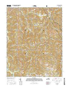
2016 Map of Pound
USGS Topo · Published 2016About this map
Jefferson National Forest dominates the northwestern corner of this study, where the terrain breaks into a complex network of hollows and ridges. The settlement of Pound sits at the confluence of the S Fork Pound River and Indian Creek, serving as a focal point for the region's transport along Bus 23. This 2016 survey illustrates the deep-rooted family history of the area through an exceptionally high density of small cemeteries, including Hamilton Cemetery, Hillman Cemetery, and Robinson Cemetery, which are scattered across the slopes of Indian Ridge and Bold Camp Mountain. The landscape is defined by the Indian Gap Tennessee Valley Divide, where numerous branches like Dotson Creek and Turkey Branch begin their descent. To the south, the settlement of Hurricane occupies the lower elevations near the Hurricane Branch, showing the persistent pattern of ridge-and-hollow habitation in this part of Wise County.
Find a feature on this map
143 named features on this map. Tap any name to fly to it.
Don’t see what you’re looking for? This feature index may not catch every label — zoom into the map to look around manually.
Map Details
Editions of this 2016 Pound Map
This is the sole edition of this map. No revisions or reprints were ever made.
Other maps of this area

1886 · Grundy
USGS Topo · 1:125,000

1890 · Whitesburg
USGS Topo · 1:125,000

1890 · Grundy
USGS Topo · 1:125,000

1892 · Grundy
USGS Topo · 1:125,000

1892 · Whitesburg
USGS Topo · 1:125,000

1894 · Estillville
USGS Topo · 1:125,000

1897 · Bristol
USGS Topo · 1:125,000

1902 · Bristol
USGS Topo · 1:125,000

1912 · Pound
USGS Topo · 1:48,000

1913 · Clintwood
USGS Topo · 1:62,500