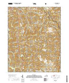
2019 Map of Pound
USGS Topo · Published 2019About this map
The Jefferson National Forest dominates the northwestern corner of this territory, where the terrain transitions into a dense network of hollows and ridges. The town of Pound sits near the confluence of the S Fork Pound River and several smaller tributaries, serving as a focal point for the surrounding mountain communities. This 2019 survey documents a landscape deeply etched by family history, evidenced by the high density of small burial grounds such as Boggs Cem, Hamilton Cem, and Screech Cem that dot the hillsides. Movement through the region is dictated by the topography, with roads like Bold Camp Rd and Indian Creek Rd following the narrow valley floors. Smaller settlements like Bean Gap and Hurricane appear as tight clusters of activity along these transit corridors, while landmarks like Bold Camp Mtn and Indian Mtn define the high ground between the Dickenson and Wise county line.
Find a feature on this map
137 named features on this map. Tap any name to fly to it.
Don’t see what you’re looking for? This feature index may not catch every label — zoom into the map to look around manually.
Map Details
Editions of this 2019 Pound Map
This is the sole edition of this map. No revisions or reprints were ever made.
Other maps of this area

1886 · Grundy
USGS Topo · 1:125,000

1890 · Whitesburg
USGS Topo · 1:125,000

1890 · Grundy
USGS Topo · 1:125,000

1892 · Grundy
USGS Topo · 1:125,000

1892 · Whitesburg
USGS Topo · 1:125,000

1894 · Estillville
USGS Topo · 1:125,000

1897 · Bristol
USGS Topo · 1:125,000

1902 · Bristol
USGS Topo · 1:125,000

1912 · Pound
USGS Topo · 1:48,000

1913 · Clintwood
USGS Topo · 1:62,500