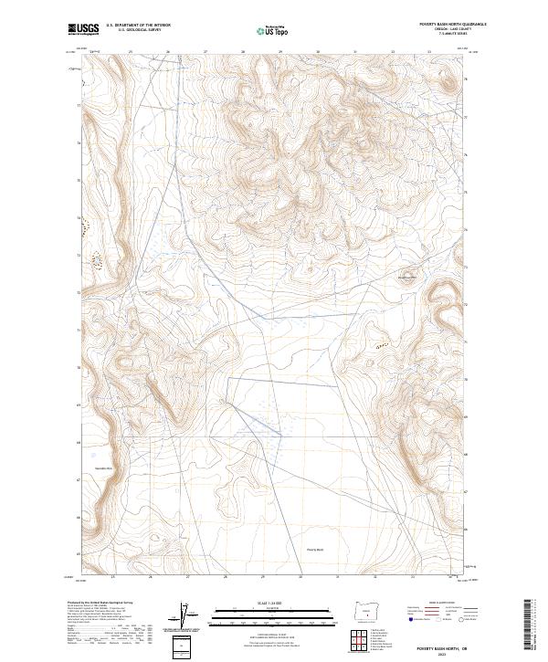
2023 Map of Poverty Basin North
USGS Topo · Published 2023About this map
Poverty Basin defines the southern extent of this high desert terrain in Oregon’s Lake County. The landscape is characterized by prominent geological features like Saunders Rim to the west and Doughnut Mtn to the east, illustrating the complex topography of the Oregon outback. This 2023 survey by the U.S. Geological Survey maps a region defined largely by its Public Land Survey System divisions, specifically across Townships 28S, 29S, and 30S. The presence of ephemeral wetlands and drainage patterns between these volcanic rises reflects the arid environmental character of the basin. This map serves as a modern baseline for researchers examining the drainage networks and land management boundaries within this part of the Great Basin.
Find a feature on this map
9 named features on this map. Tap any name to fly to it.
Don’t see what you’re looking for? This feature index may not catch every label — zoom into the map to look around manually.
Map Details
Editions of this 2023 Poverty Basin North Map
This is the sole edition of this map. No revisions or reprints were ever made.
Other maps of this area

1955 · Crescent
USGS Topo · 1:250,000

1955 · Klamath Falls
USGS Topo · 1:250,000

1957 · Crescent
USGS Topo · 1:250,000

1958 · Crescent
USGS Topo · 1:250,000

1958 · Klamath Falls
USGS Topo · 1:250,000

1970 · Crescent
USGS Topo · 1:250,000

1974 · Lake Abert
USGS Topo · 1:100,000
1984 · Alkali Buttes
USGS Topo · 1:24,000
1984 · Alkali Lake
USGS Topo · 1:24,000
1984 · Goodrich Well
USGS Topo · 1:24,000