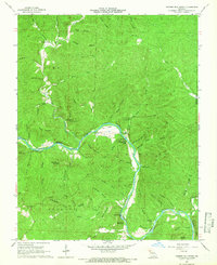
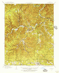
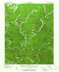
1965 Map of Powder Mill Ferry
USGS Topo · Published 1966About this map
The Current River carves a deep path through Shannon County in this mid-1960s survey, defined by its intricate network of spring-fed tributaries and limestone features. This reach of the river is notable for the Powder Mill Ferry, a vital crossing point near the convergence of Mill Creek and Powder Mill Spring. The karst topography of the Ozarks is on full display here, with numerous subterranean systems such as Marvel Cave, Blair Creek Cave, and Powder Mill Creek Cave documented alongside prominent water sources like Blue Spring and Clint Williams Spring.
Find a feature on this map
63 named features on this map. Tap any name to fly to it.
Don’t see what you’re looking for? This feature index may not catch every label — zoom into the map to look around manually.
Map Details
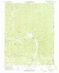
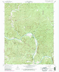
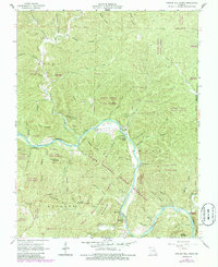
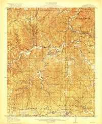
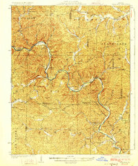
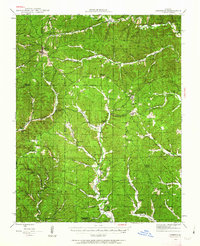
Editions of this 1965 Powder Mill Ferry Map
4 editions found
Other maps of this area
1915 · Eminence
USGS Topo · 1:62,500
1917 · Eminence
USGS Topo · 1:62,500
1928 · Cardareva
USGS Topo · 1:62,500
1944 · Corridon
USGS Topo · 1:62,500
1945 · Round Spring
USGS Topo · 1:62,500

1947 · Sinkin
USGS Topo · 1:48,000
1947 · Corridon
USGS Topo · 1:62,500

1949 · Round Spring
USGS Topo · 1:62,500

1949 · Rolla
USGS Topo · 1:250,000

1949 · Cardareva
USGS Topo · 1:62,500