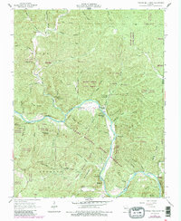
1965 Map of Powder Mill Ferry
USGS Topo · Published 1985About this map
Powder Mill Ferry and the surrounding Current River corridor dominate this mid-century survey of the Shannon County backcountry. The map documents a landscape defined by its hydrogeology, where massive springs like Blue Spring, Powder Mill Spring, and Marvel Spring emerge from the base of steep hills. This era reflects the early integration of the Ozark National Scenic Riverways, showing the transition of the river from a local industrial and transport artery to a protected recreational corridor.
Find a feature on this map
65 named features on this map. Tap any name to fly to it.
Don’t see what you’re looking for? This feature index may not catch every label — zoom into the map to look around manually.
Map Details
Editions of this 1965 Powder Mill Ferry Map
4 editions found
Other maps of this area

1915 · Eminence
USGS Topo · 1:62,500

1917 · Eminence
USGS Topo · 1:62,500

1928 · Cardareva
USGS Topo · 1:62,500

1944 · Corridon
USGS Topo · 1:62,500

1945 · Round Spring
USGS Topo · 1:62,500

1947 · Sinkin
USGS Topo · 1:48,000

1947 · Corridon
USGS Topo · 1:62,500

1949 · Round Spring
USGS Topo · 1:62,500

1949 · Rolla
USGS Topo · 1:250,000

1949 · Cardareva
USGS Topo · 1:62,500